Difference between revisions of "Heightfield Clip Vertical"
(Conformed existing page to new layout. Updated example images and slightly modified text descriptions.) |
m (Conformed descriptions for "when checked".) |
||
| Line 7: | Line 7: | ||
* '''Name:''' This setting allows you to apply a descriptive name to the node, which can be helpful when using multiple Heightfield clip vertical nodes in a project. | * '''Name:''' This setting allows you to apply a descriptive name to the node, which can be helpful when using multiple Heightfield clip vertical nodes in a project. | ||
| − | * '''Clip peaks:''' When checked | + | * '''Clip peaks:''' When checked, all parts of the heightfield above the specified height in metres are cut off at that height. For example, all parts of the heightfield above 100 metres are set to 100 metres. |
| − | * '''Clip valleys:''' When checked | + | * '''Clip valleys:''' When checked, all parts of the heightfield below the specified height in metres are raised up to that height. For example, all parts of the heightfield below 0 metres are raised up to 0 metres. |
<br /> | <br /> | ||
Latest revision as of 00:35, 10 February 2021
Overview[edit]
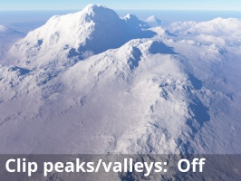
The Heightfield Clip Vertical node can be used to cut off high or low points of a heightfield. This has the effect of creating plateaus and plains from the clipped areas.
Settings:
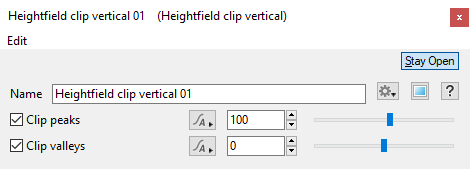
- Name: This setting allows you to apply a descriptive name to the node, which can be helpful when using multiple Heightfield clip vertical nodes in a project.
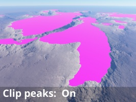
- Clip peaks: When checked, all parts of the heightfield above the specified height in metres are cut off at that height. For example, all parts of the heightfield above 100 metres are set to 100 metres.
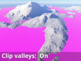
- Clip valleys: When checked, all parts of the heightfield below the specified height in metres are raised up to that height. For example, all parts of the heightfield below 0 metres are raised up to 0 metres.
A heightmap or heightfield is an array of height values, usually in a grid which describe the height at specific points in a defined area. Heightfields are used to represent real-world and virtual terrain in a specific, easily converted format. Most heightfields can be represented as simple image data in grayscale, with black being minimum height and white being maximum height.
A single object or device in the node network which generates or modifies data and may accept input data or create output data or both, depending on its function. Nodes usually have their own settings which control the data they create or how they modify data passing through them. Nodes are connected together in a network to perform work in a network-based user interface. In Terragen 2 nodes are connected together to describe a scene.


