Heightfield Resize
Overview[edit]
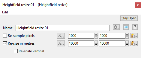
Heightfield Resize allows you to adjust the "size" of your heightfield. You can adjust the size in pixels, which affects the resolution of the heightfield, or adjust the size in meters, which affects the area the heightfield covers in your scene.
Settings:
- Re-sample Pixels: When checked, the heightfield resolution will be resampled according to the settings to the right. Enter values for the resolution of the heightfield in the X and Z horizontal directions. The heightfield's resolution does not define the area it covers, but rather the resolution or "detail" of the heightfield itself, i.e. how many pixels of individual height information there are. This combined with the size of the heightfield in meters determines the detail relative to real-world measurements. For example, if you have a heightfield 1000x1000 pixels that covers 10,000x10,000 metres, you will have 1 pixel of height information for every 10 meters of world space. This is considered a medium level of detail for a heightfield. To increase detail you would increase the number of pixels and leave the size in metres the same. Be aware that increasing the resolution does not create new detail.
- Re-size In Metres checkbox: When checked, the area the heightfield covers will be resized according to the settings to the right. Enter values for the area of coverage for the heightfield in the X and Z horizontal directions. The heightfield's area of coverage has no effect on its resolution, so you can stretch any pixel resolution to cover an area of any size. The heightfield area in meters, combined with the resolution of the heightfield in pixels, determines the detail relative to real-world measurements. For example, if you have a heightfield 1000x1000 pixels that covers 10,000x10,000 metres, you will have 1 pixel of height information for every 10 meters of world space. This is considered a medium level of detail for a heightfield. To increase detail you would increase the number of pixels and leave the size in metres the same.
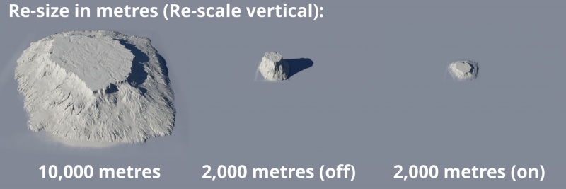
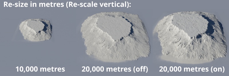
- Re-scale vertical: When checked, the vertical height adjusts relative to the changes made in the “Re-size in metres” setting, in order to maintain the original proportions of the heightfield. When unchecked, or disabled, the vertical height remains unchanged.
A heightmap or heightfield is an array of height values, usually in a grid which describe the height at specific points in a defined area. Heightfields are used to represent real-world and virtual terrain in a specific, easily converted format. Most heightfields can be represented as simple image data in grayscale, with black being minimum height and white being maximum height.
A sample refers to a value or set of values at a point in time and/or space. The defining point of a sample is that it is a chosen value out of a continuous signal. In Terragen 2 it is usually a mathematical (procedural) function that is being sampled.
A single element of an image which describes values for color and/or intensity, depending on the color system which the image uses. Groups of ordered pixels together form a raster image.


