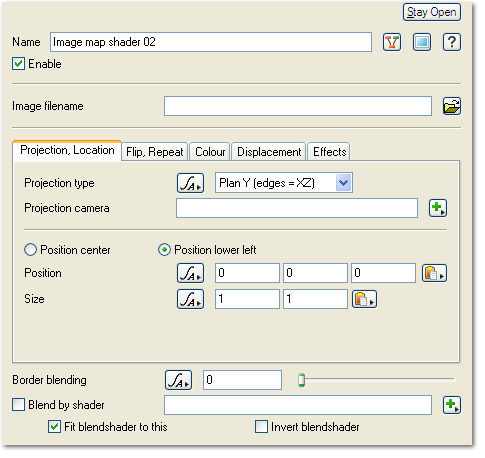
Image Map Shader
Node Description and Purpose: he Image Map Shader allows you to load an external image map file in one of several supported formats, including TGA, TIFF, SGI, BMP, PNG and JPG. You can control the way the texture is applied in the scene - the "projection" - the position, as well as whether to flip or repeat the loaded image, adjust the colour values, determine whether displacement is applied, and control other image-specific effects.
Additional tabs for Image Map Shader[edit]
Literally, to change the position of something. In graphics terminology to displace a surface is to modify its geometric (3D) structure using reference data of some kind. For example, a grayscale image might be taken as input, with black areas indicating no displacement of the surface, and white indicating maximum displacement. In Terragen 2 displacement is used to create all terrain by taking heightfield or procedural data as input and using it to displace the normally flat sphere of the planet.
