Richard Fraser
Visual Effects artisan Richard Fraser is a leading Terragen environmental artist, working on many projects such his spectacular work on the highly acclaimed ‘Ad Astra’. So, let’s find out a little more about Richard.

Hello Richard, it seems you've been using Terragen for a long time!
Yes, I’ve been using Terragen since v0.93 and then I jumped onto the alpha version of Terragen 2 sometime around 2004. My first landscape rendering program was something called Forrester for POVRay, then Bryce. However, in my day to day work I still use Houdini, Maya, and Lightwave as the backbone of my 3D work together with Xfrog and Speedtree.
What kinds of shots have you been mostly creating?
In my personal work I like to create shots that either tell a story or evoke the feeling that there might be one to be told.

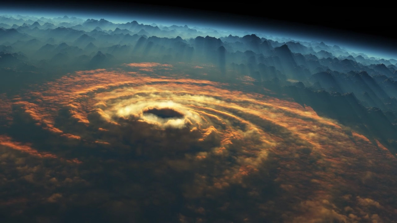
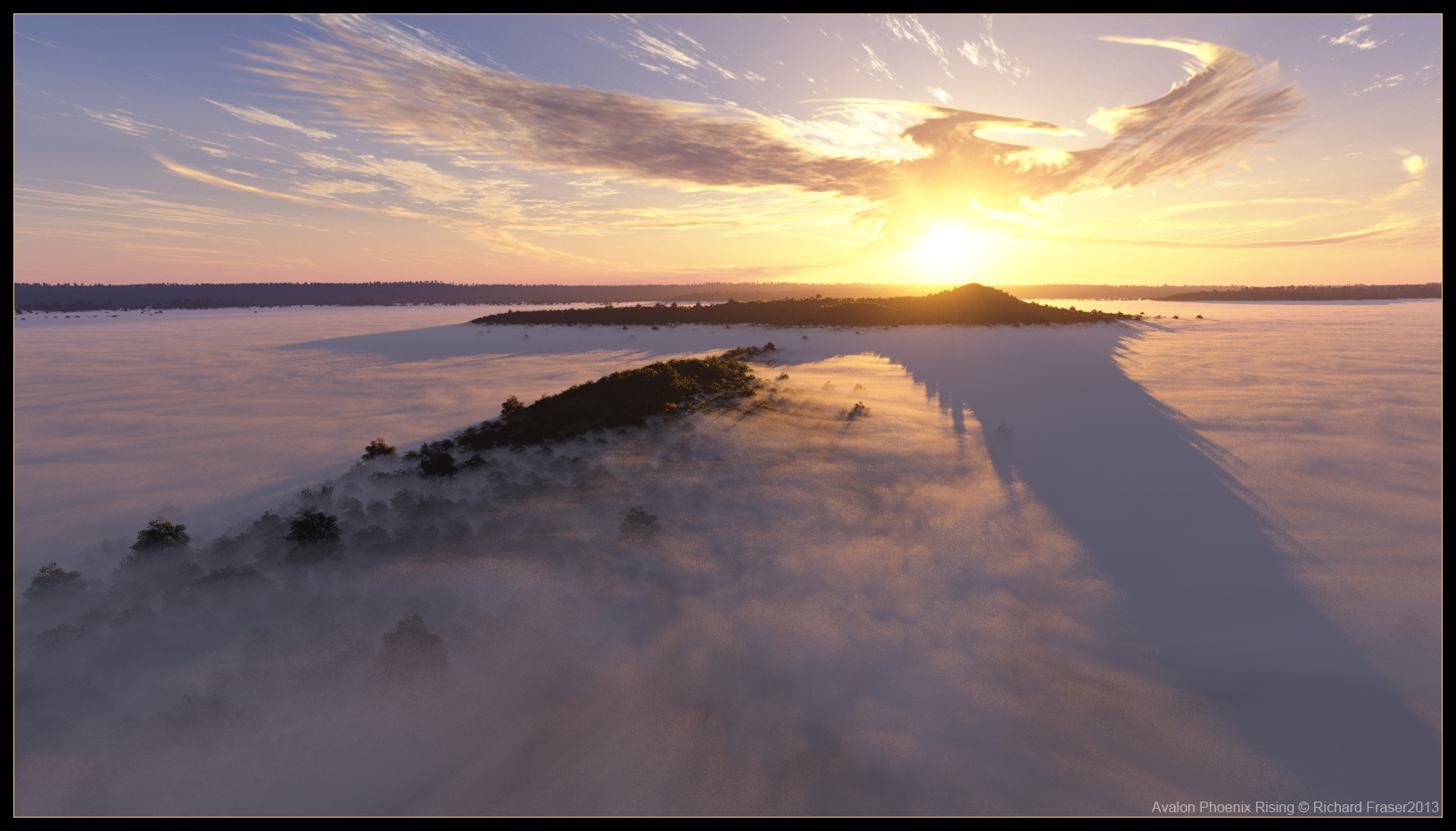
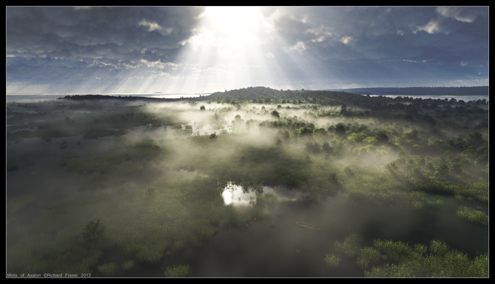
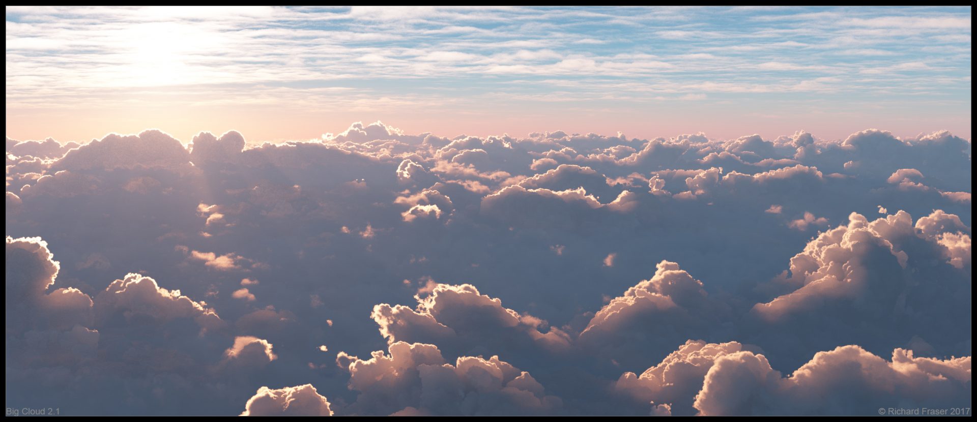
Your images of sunsets and clouds are amazing. Can you explain your approach to building them?
The 3D preview is very fast and helpful when dealing with the atmosphere and clouds. It’s easy to see the results of changes in almost real-time; well maybe a cropped area helps! I like to raise the haze colour to 0.75, just a personal preference, and bring up the exposure a little. To get clouds to exhibit that glorious underlit quality the sun needs to be below the horizon and the clouds need to be quite high. You can also use quite a long lens and zoom in to capture detail that is crunched down on the horizon.
Do you develop materials and shaders outside of Terragen and what is your process for importing 3D assets into Terragen?
Does Terragen still surprise you occasionally?
What companies and projects have you used Terragen on?
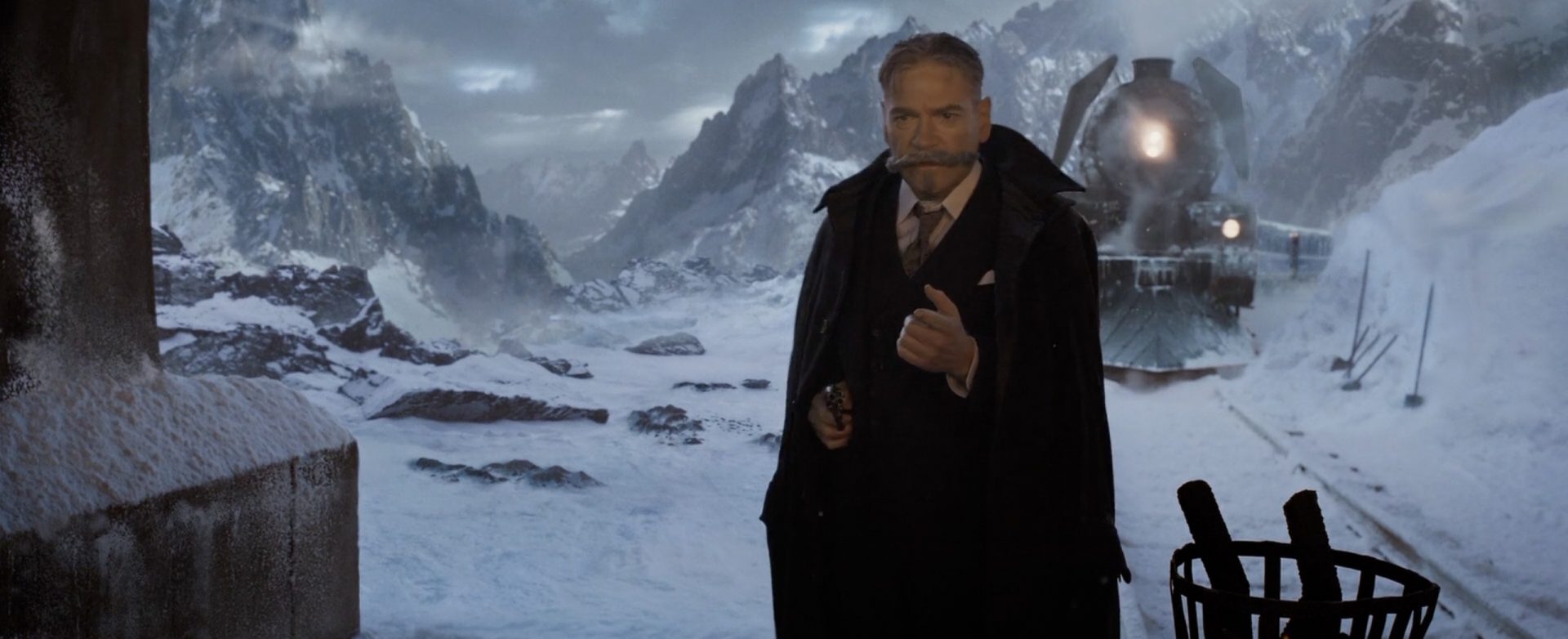
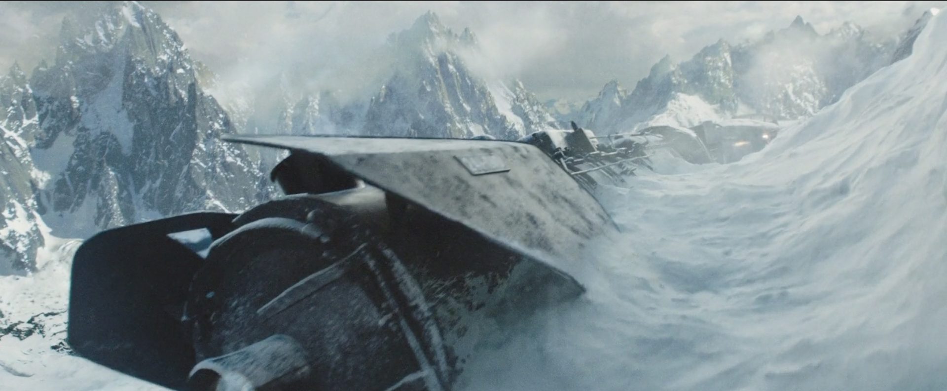
Some of the projects I’ve worked on have been Murder on the Orient Express (MPC), The Mountain Between Us (MPC), Jumanji (MPC), Ad Astra (MPC), League of Gods (Luxa Studio), and the feature film adaptation of The Three Body Problem.
Which project do you feel most proud of, and why?
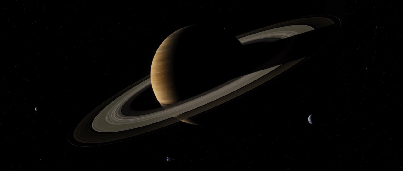
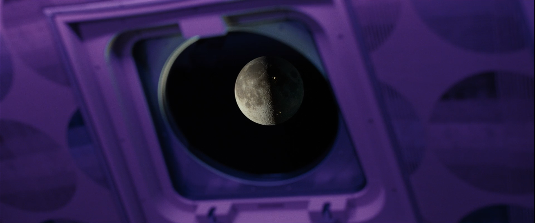
I really enjoyed working on Ad Astra as it involved a lot of technical challenges and problem solving. They even flew me out to Vancouver! Those were the days!
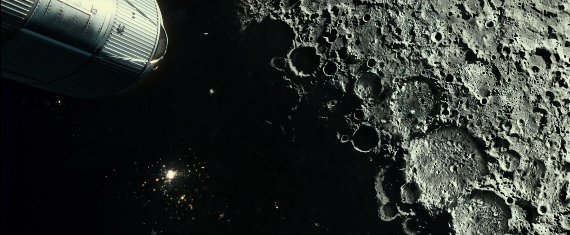
For the film I created a very high resolution Saturn along with it’s rings and moons. They wanted the moons animated too! I also created the North Pole of the Moon and Mars.
NASA has a lot of publicly available imagery from it’s various interplanetary missions and these proved invaluable. The surface texture of Saturn is taken from the Jupiter spherical maps but very greatly altered. The horizontal swirled bands were used as a base and copied over each other multiple times. At the time views of Saturn showed only very indistinct hazy layers and I took artist liberty to say that if we were closer we should be able to see more detail.
For the North Pole of the Moon I used a 92K displacement map which I chopped down to the top half and then further chopped into quarters so I only used a small portion of the full map but it still projected correctly. On top of this I used Terragen Power Fractals and a function graph to add random displacement and craters.
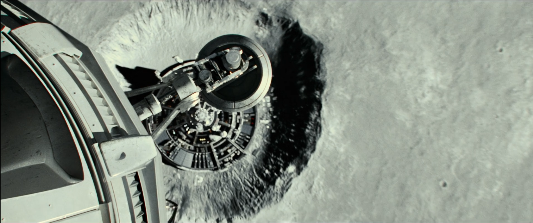
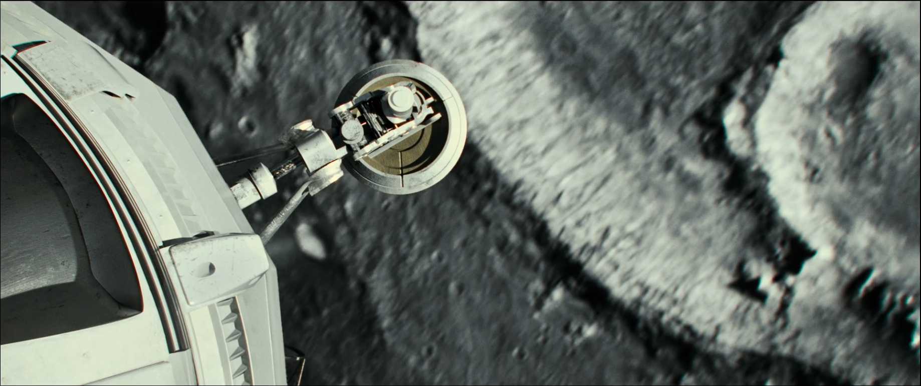
For Mars I used a displacement and a colour map running at 46k. I then took colour samples from the map and used those as the base for a series of power fractals to help break up the planet’s surface. For the shots closer to the surface I used HiRISE, very high resolution Mars Global Surveyor displacement maps. These ranged from 5km wide to maybe 50 km across, a very much smaller area than the global maps showed but they were able to show very distinct Mars-type terrains. The issue here was that they were often sloped across the terrain capture, being several hundred meters higher on one side of the map than the other. This was fixed by creating a smooth EXR gradient running in the opposite direction to the terrain capture and subtracting one from the other leaving just a “normalized” displacement. These were then scattered around for low level shots to provide realistic mars terrain.
What has been the most challenging project?
I think the most challenging project to date must have been the Panjshir Valley Emeralds project.
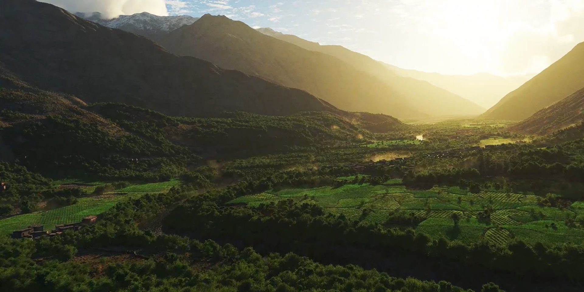
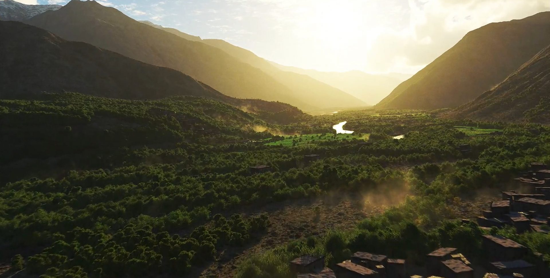
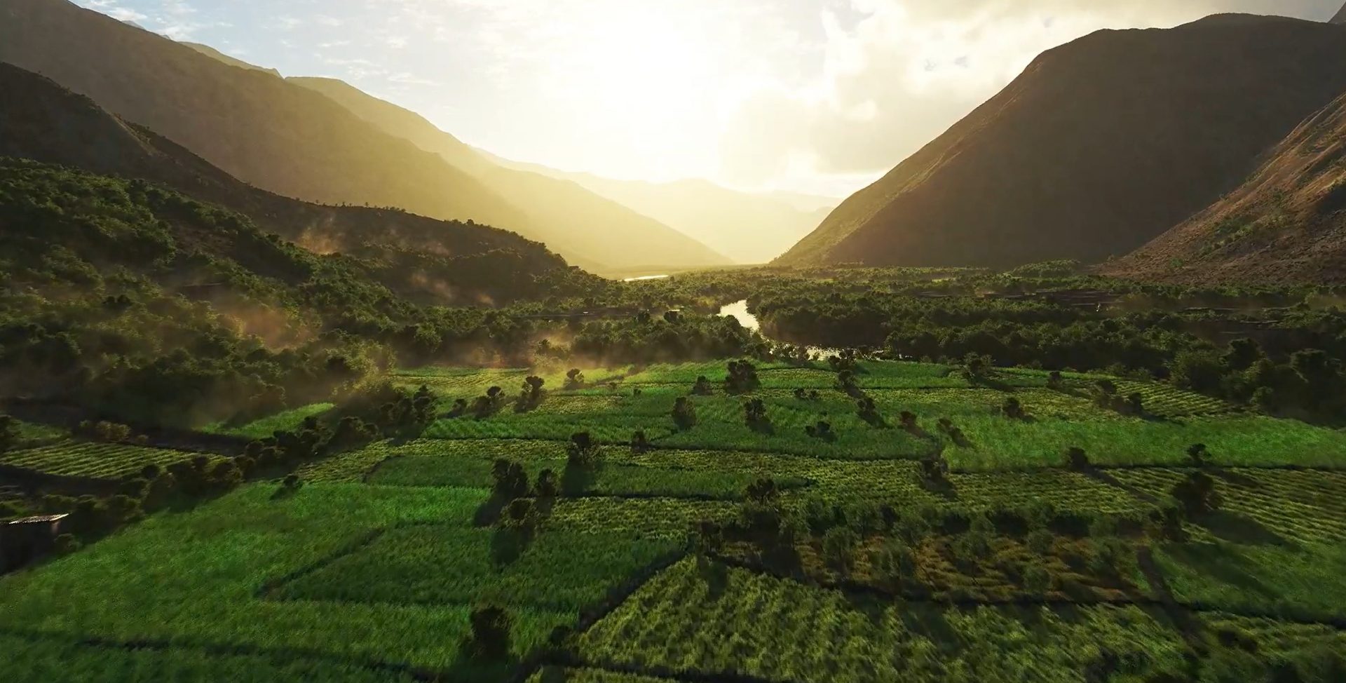
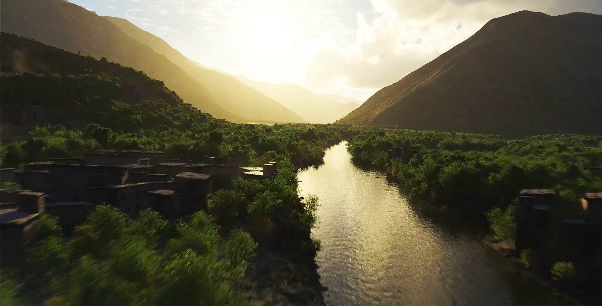
I was asked to recreate a helicopter flight up the valley. At the time no unauthorized helicopter or drone flights were allowed due to safety concerns, both natural and military. I used publicly available USGS GEOTIFF DEMs for the large scale valley structure and referenced Google Earth to extract more localized data such as the shape of the river, field boundaries and villages.
In Photoshop I built up a multi-layered document that contained greyscale images for the field systems, river, roads and village areas. Having them all in one document meant that everything stayed aligned and I could export separate displacement maps for each type of terrain displacement. It also meant I could use lower resolution placeholders to help place the village models. For the village models I created six houses, each with different faces and roofs so they could be duplicated to create a larger variety and avoid repetition.
Due to the size of the project everything was rendered at a very low resolution for client feedback with only key frames at full resolution. Once everything was signed off a full scale 4k render was sent to the Pixel Plow render farm.
How do you think Terragen balances very technical aspects verses purely artistic aspects?
An odd question because it can be answered both ways. It’s easy to load geo referenced heightmaps and satellite photos which are pretty technical but conversely, it is also very simple to just dive in creatively and make environments from scratch.
What part of Terragen impresses you the most, and what do you consider its most impressive feature overall?
Almost limitless terrain and the ability to handle truly massive poly counts in both individual objects and populations. I think the best part for me is its easy ability to prototype an idea using only a few nodes. Obviously, scenes often end up with hundreds of nodes and can become hugely complex, but in Terragen it can be a simple and quick task to see if an idea is worth pursuing. I also like how Terragen’s atmosphere requires no setup right out of the box.
What UI changes and tools would you like to see implemented within Terragen?
I would love it if we could get a Houdini importer; just think how fantastic it would be to generate towns or cities inside Terragen! I’d like to see stepped rotation in the populator, this would also be great for helping to create more structured randomness and especially useful in creating cities. The ability to read FBX and ABC files fully would position Terragen centrally to the production pipeline. Also, VDB import for externally created clouds would be great, and other than that make it faster!
Where do you think Terragen is being under utilized?
I think the ‘Simple Shape shader‘ is very under utilised as a layout tool. You can very quickly set up large scenes with landscape features exactly where you want them using multiple Simple Shape shaders.
As I mentioned elsewhere Terragen’s ability to handle huge poly counts and massive instances has the potential to place it in a central position in a production pipeline. It can create great results as a stand-alone application but with better integration into industry standard exchange formats it could become the application around and through which all the other apps talk to each other.
Thank you for your time Richard, we’re all looking forward to seeing your next work!
Richard is always on the lookout for interesting projects and can be contacted at richardfraservfx@gmail.com

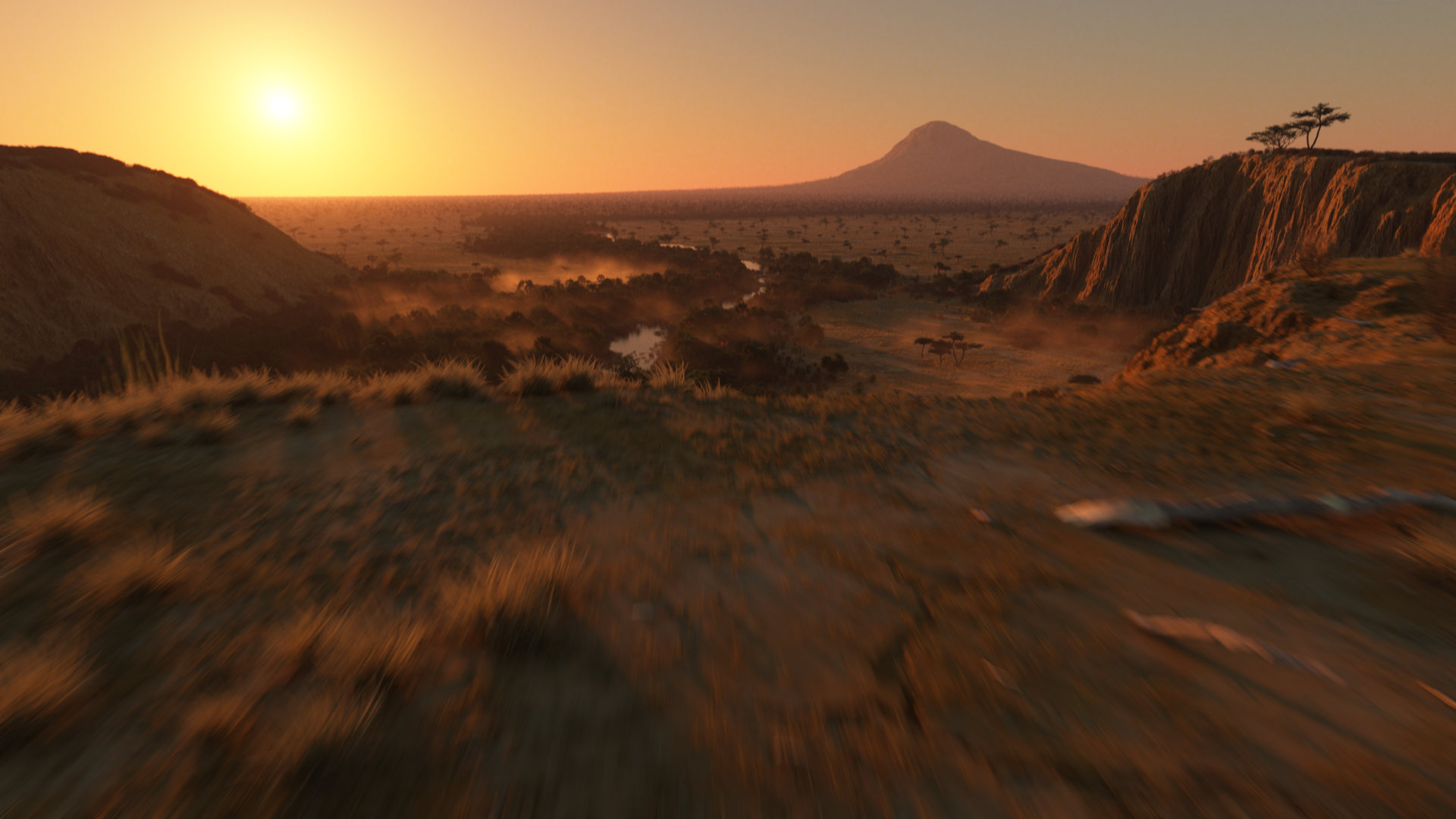
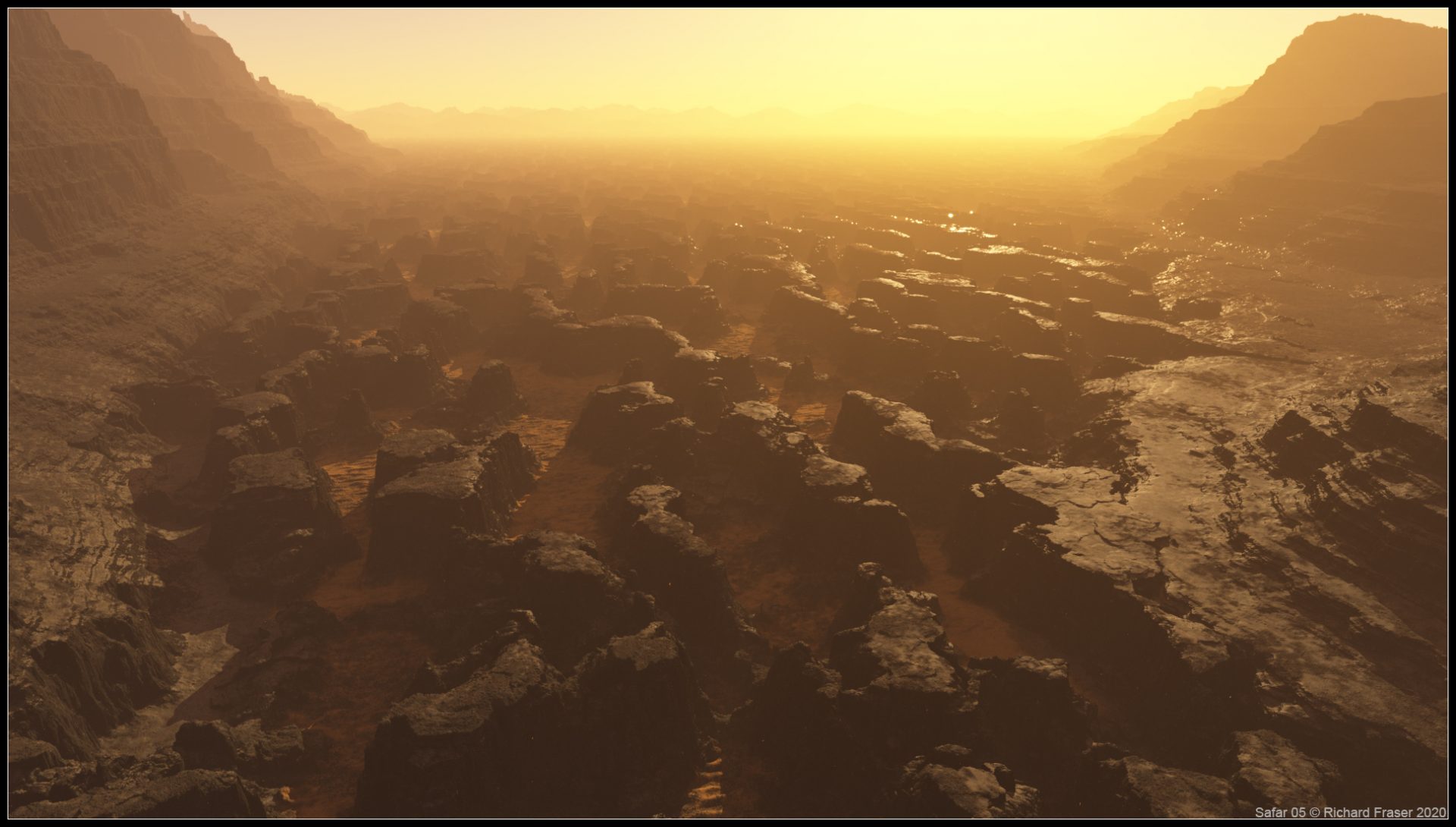
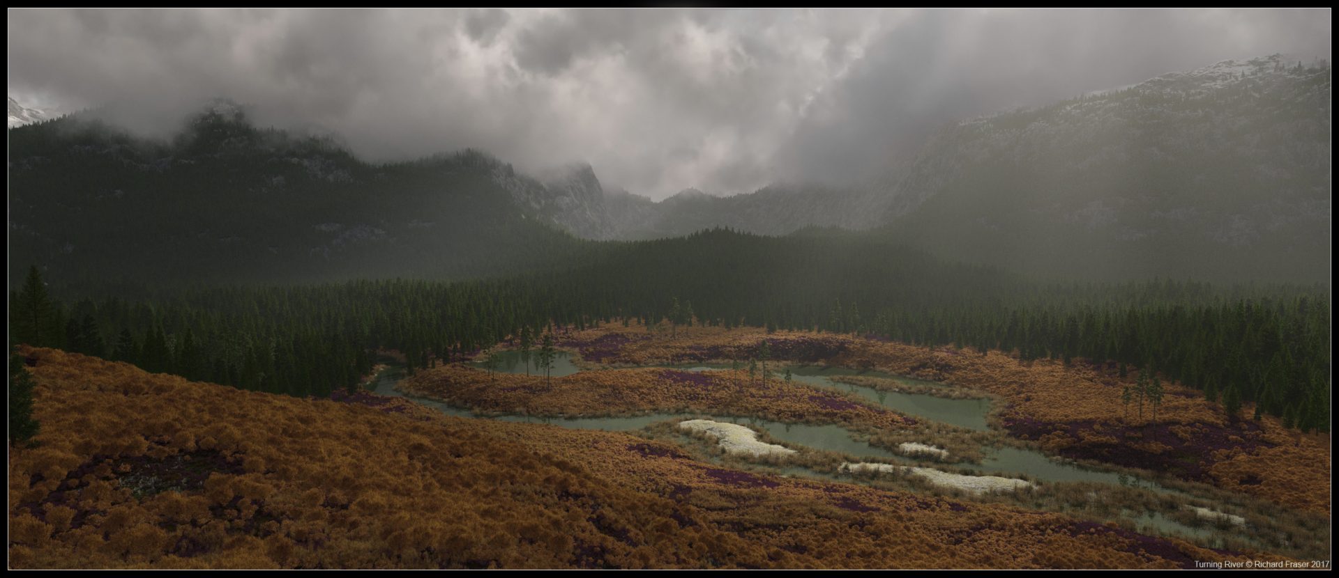
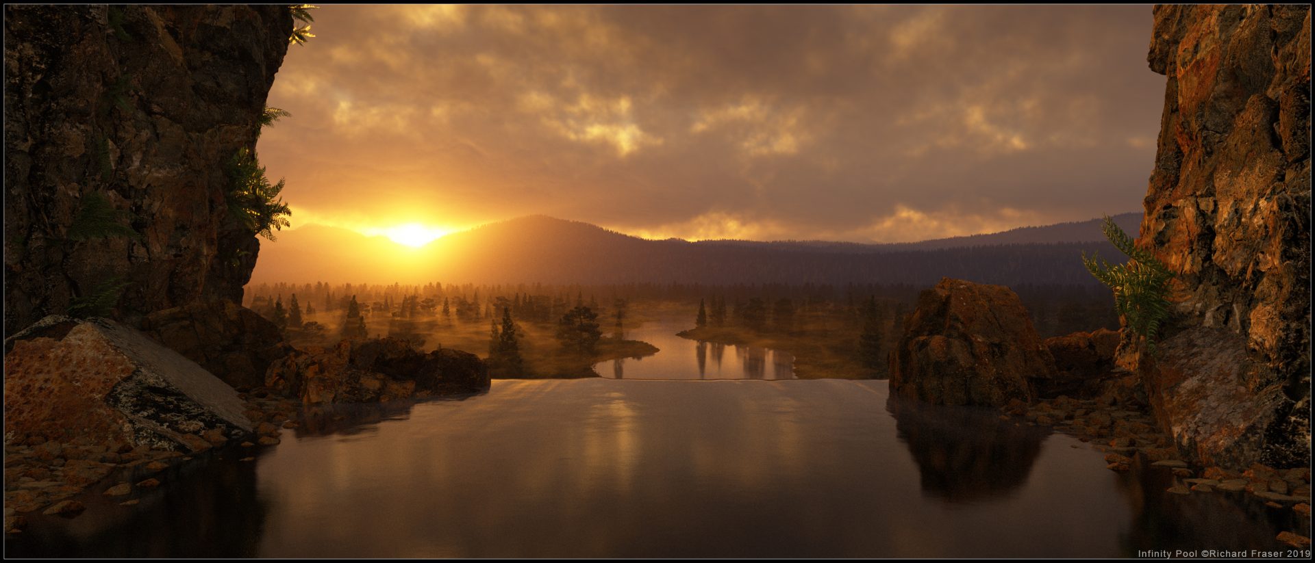
Some of the great Terragen images from Richard’s website.